The GR10 Trail by Brian Johnson
Author:Brian Johnson
Language: eng
Format: epub
ISBN: 9781783624010
Publisher: Cicerone Press
Published: 2019-08-15T00:00:00+00:00
The GR10 turns right and climbs to the left of the Coubous stream. An alternative route, the GR10C (not described in this guide), continues up the D918. The waymarking may not be clear but you stay left of the wood to reach the old road (1hr 20min, 1538m). Go straight across and continue up the left-hand side of the valley, joining a track. Eventually cross the stream and reach a path junction (2hr). Turn left and follow a clear stony path. You are back into a typical granite landscape, which provides magnificent scenery. The stream disappears underground for some time and there are good campsites in the meadows where it reappears (2hr 35min). There are many strands to the path, with the GR10 waymarked to avoid the meadows while most tourists use the old paths through the meadows. You cross the stream several times before eventually reaching the Cabane dâAygues Cluses (3hr 35min, 2150m) by the shallow Lac de Coueyla-Gran. This small bothy was in good condition in 2015.
The GR10 switchbacks right before veering S then SW and crossing several streams before passing between the two Lacs de Madamète (swimming possible) (4hr 5min). As usual when crossing high passes, the waymarks get scarcer, to be replaced by cairns. Continue roughly SSW, passing left of two shallow tarns and left of a possibly ice-bound lake to reach the Col de Madamète (4hr 55min, 2509m). Pic de Madamète (2657m) to the right is an easy peak with a cairned path to the summit (there and back in 25min).
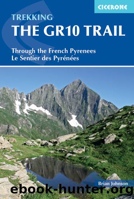
Looking southeast from Pic de Madamète
Download
This site does not store any files on its server. We only index and link to content provided by other sites. Please contact the content providers to delete copyright contents if any and email us, we'll remove relevant links or contents immediately.
Spell It Out by David Crystal(36243)
Underground: A Human History of the Worlds Beneath Our Feet by Will Hunt(12236)
A Year in the Merde by Stephen Clarke(5531)
Venice by Jan Morris(2666)
Claridge's: The Cookbook by Nail Martyn & Erickson Meredith(2475)
My Paris Kitchen: Recipes and Stories by Lebovitz David(2351)
A TIME OF GIFTS by Patrick Leigh Fermor(2267)
The Plantagenets by Dan Jones(2177)
Welcome to the Goddamn Ice Cube by Blair Braverman(2120)
From Russia with Lunch by David Smiedt(2075)
The Finnish Way by Katja Pantzar(2072)
Top 10 Prague (EYEWITNESS TOP 10 TRAVEL GUIDES) by DK(2068)
Bang Poland: How To Make Love With Polish Girls In Poland by Roosh V(2043)
The Isle of Mull by Terry Marsh(2020)
A TIME TO KEEP SILENCE by Patrick Leigh Fermor(1975)
Rick Steves London 2018 by Rick Steves & Gene Openshaw(1938)
Insight Guides Experience Tokyo by Insight Guides(1928)
A Taste of Paris by David Downie(1928)
Merde in Europe by Stephen Clarke(1835)
